Context
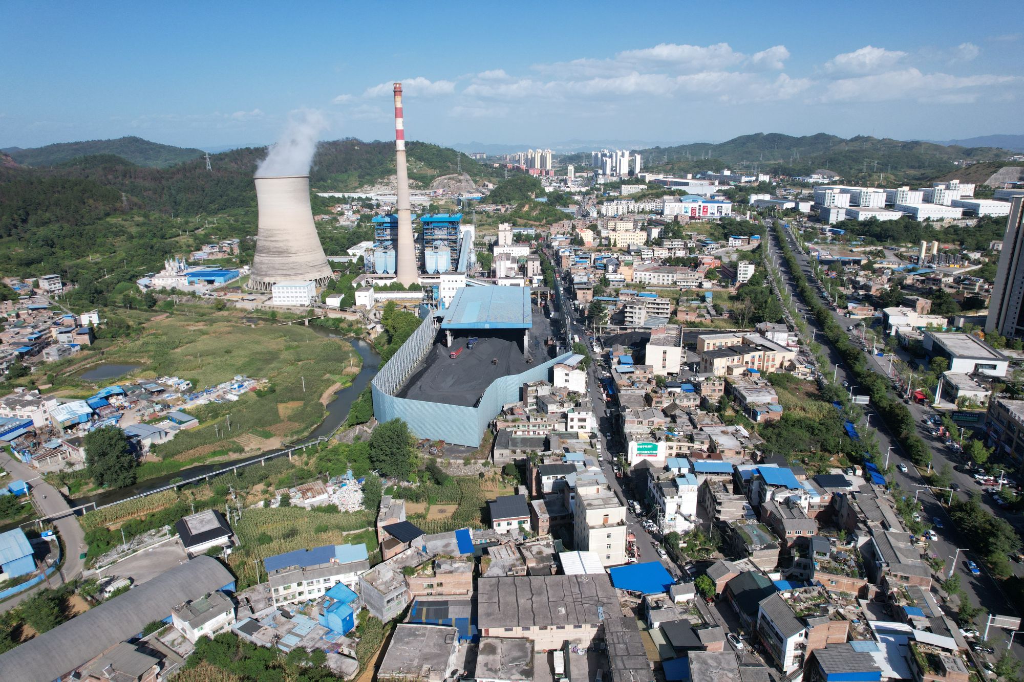
Bijie is a shrinking industrial city whose urban development remains closely tied to manufacturing and industrial tax revenue. In the study area, continued outward expansion met ecological and legal development constraints, while established industrial facilities, logistics uses, residential neighborhoods, and waterways already competed for limited space. This combination created a paradox: land continued to urbanize, yet suitable residential land remained locally scarce.
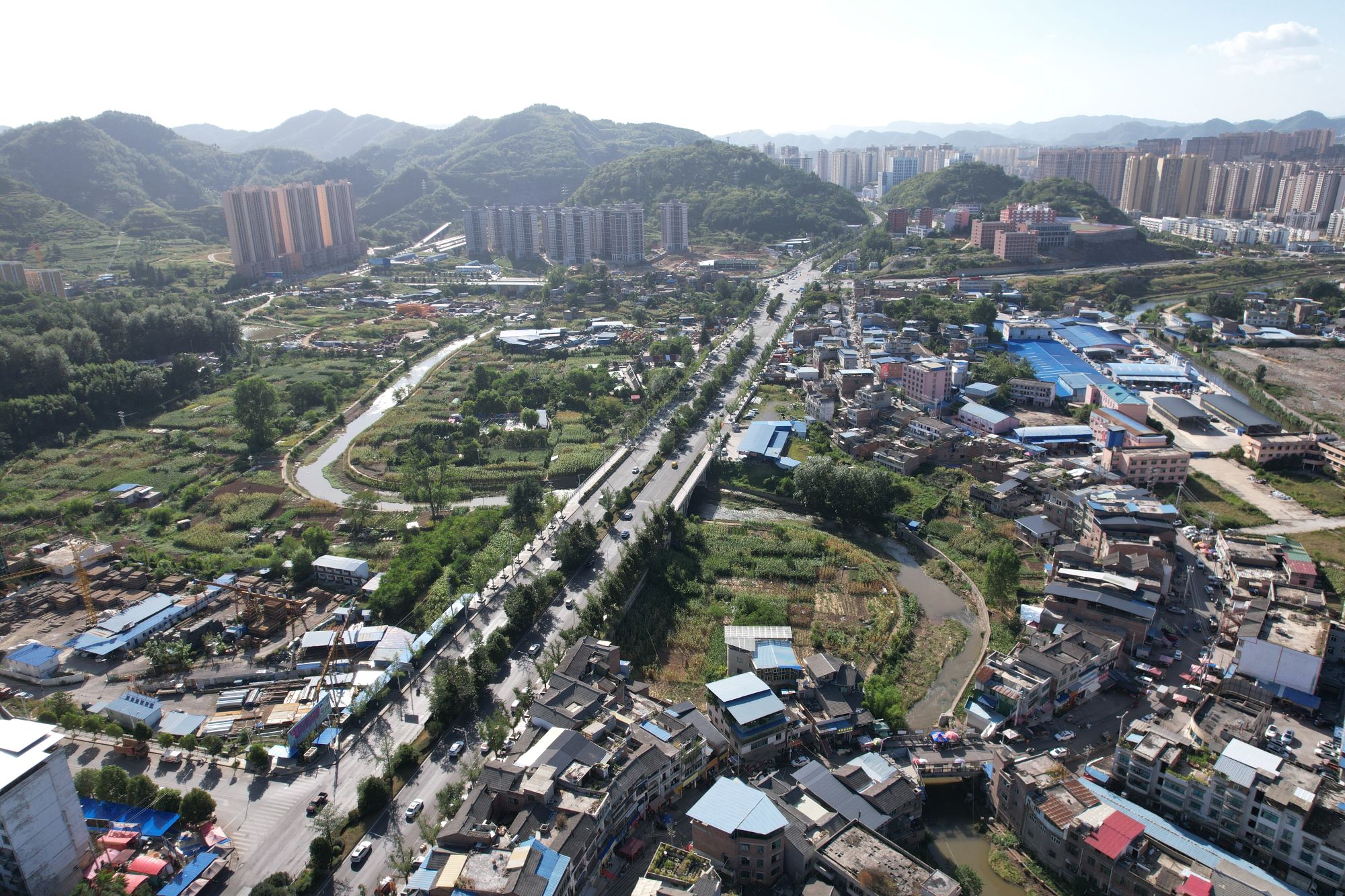
Industrial facilities, residential neighborhoods, waterways, and new development meet within the study area.
Research objective
The research examined how reliance on industrial tax revenue encouraged expansion into ecologically or legally restricted areas and intensified localized shortages of residential land supply. It sought to identify where land conversion was feasible, where industrial activity should continue or be upgraded, and how development could be sequenced without undermining the city's fiscal base.
The study also addressed the corridor's immediate planning constraints: legacy industrial pollution, outdated facilities embedded within residential areas, fragmented infrastructure, and conflict between industrial relocation and local employment and revenue. Large-scale clearance was neither economically nor institutionally feasible, while uncontrolled redevelopment risked worsening environmental and social pressures.
Analytical framework
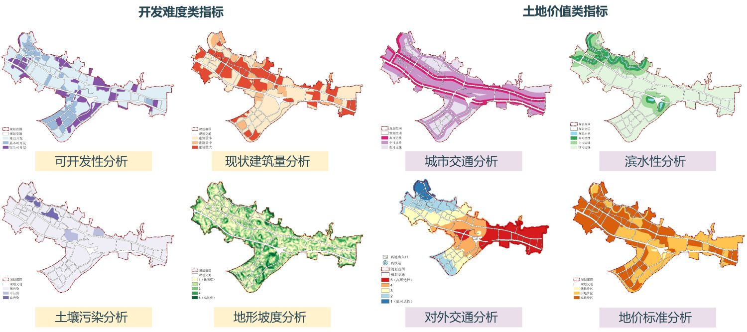
Eight dimensions were used to evaluate where land conversion and new development would be more or less appropriate.
Using SQL, the project assembled a parcel-level spatial database that integrated land attributes, market indicators, industrial activity, price data, environmental constraints, infrastructure capacity, accessibility, and related planning evidence. GIS and the Analytic Hierarchy Process were then used to construct a multi-criteria suitability framework across eight dimensions, making the trade-offs between residential development, industrial continuity, public investment, and environmental risk explicit.
Development suitability
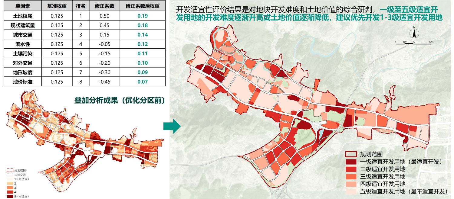
The composite assessment translates the eight-dimensional framework into five levels of development suitability.
From analysis to planning
The assessment informed a corridor-based, phased land-conversion strategy rather than a single large-scale redevelopment scheme. It identified areas suited to near-term residential development, gradual industrial upgrading or relocation, environmental remediation, and longer-term reserve. Development stages were aligned with fiscal capacity, while land-use intensity, infrastructure, transport connections, and functional buffers were reorganized to accommodate both continuing production and urban expansion.
Spatial strategy
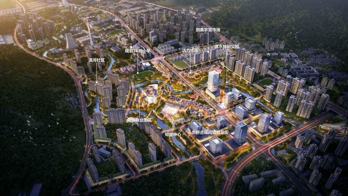
An illustrative development concept connecting new housing, public facilities, landscape, and the existing urban fabric.
Outcome
The resulting phased land-conversion priority map was adopted by the municipal government as the technical basis for district development sequencing. By connecting parcel-level evidence to an implementable spatial strategy, the project showed how localized housing pressure in a shrinking industrial city could be addressed without separating housing supply from industrial policy, environmental improvement, infrastructure investment, and municipal fiscal constraints.